Navigator
Explore what MetaXD has to offer.
Explore what MetaXD has to offer.
Begleitung raumplanerischer Prozesse mit GIS-Tools und fachlicher Unterstützung – von der Grundlagenaufnahme über Szenarien bis zur Visualisierung. Liefert die digitale Basis für fundierte Planungslösungen.
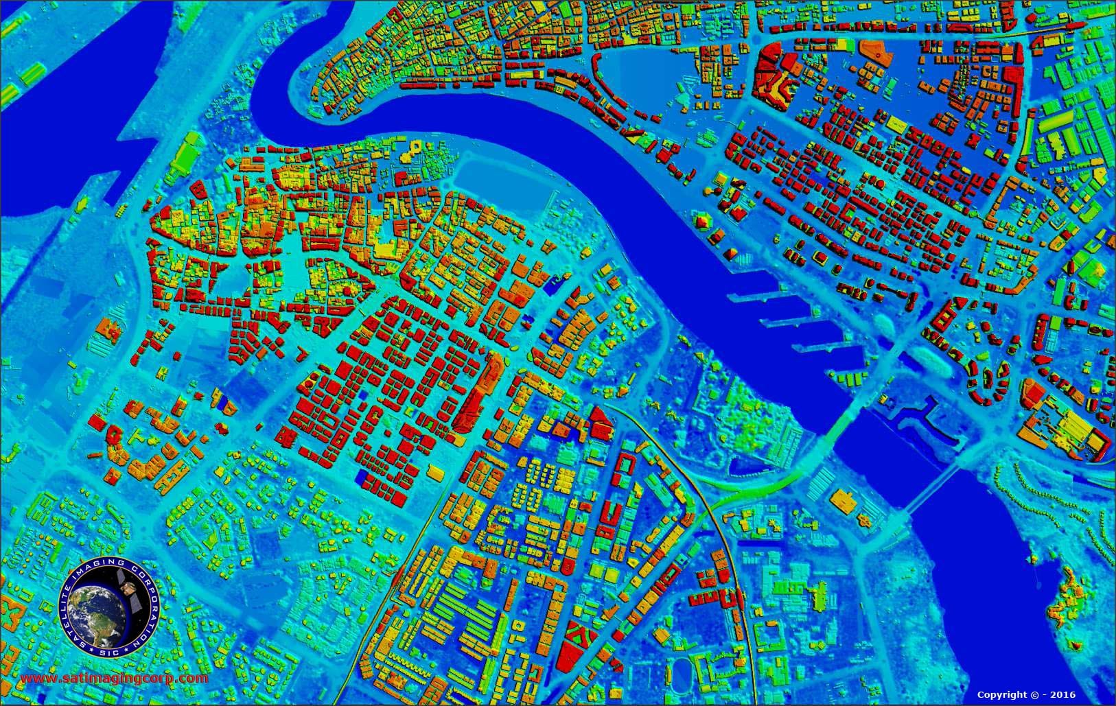
Wir begleiten Ihre raumplanerischen Prozesse mit GIS-basierten Werkzeugen und fachlicher Unterstützung. Dies umfasst die Erhebung und Visualisierung raumrelevanter Daten (z. B. Nutzungspläne) sowie die Entwicklung von Szenarien, etwa für Schulstandorte. Wir erstellen Karten und räumliche Analysen als digitale Entscheidungsgrundlage für Ihre Planung. Abschliessend integrieren wir die Planungsergebnisse in Ihre GIS-Systeme und beraten Sie bei der Strategieentwicklung.
Lieferanten:
Strategie- und Projektberatung für Raum- und Stadtplanung
Integration von Planungsergebnissen in GIS zur Pflege und Kommunikation
Karten, Diagramme und räumliche Analysen für Entscheidungsgrundlagen
Szenarioentwicklung für Flächen- und Nutzungsausweisung
Erhebung und Visualisierung raum- und stadtplanungsrelevanter Daten
Ja, Sie können beliebig viele Services in Ihren Warenkorb legen, um ein umfassendes Angebot zu erstellen.
Klicken Sie einfach auf das "X" in der oberen rechten Ecke des jeweiligen Services in Ihrem Warenkorb.
Klicken Sie auf der Service-Seite auf den Teilen-Button (Share). Dadurch wird der Link kopiert und Sie können ihn bequem an andere weiterleiten.
Das sind die konkreten Aufgaben und Leistungen, die in einem Service-Paket enthalten sind. Sie zeigen Ihnen genau, was bei der Buchung geliefert wird.
Fahren Sie mit der Maus über das Anbieter-Symbol auf der Service-Seite oder klicken Sie darauf, um mehr über den Anbieter und seine Partnerschaft mit uns zu erfahren.
Klicken Sie auf das Paket-Symbol, um den Service in Ihren Warenkorb zu legen. Sie finden dieses Symbol unter jeder Service-Karte oder oben auf der jeweiligen Detailseite.
Gehen Sie zum Marketplace und wählen Sie "Nach Kategorie filtern". Alternativ finden Sie auf jeder Service-Seite unten den Bereich "Weitere Services wie dieser".


-2.webp&w=3840&q=80&dpl=dpl_Avcc48k9VQPGwAjAgJxwjnU5L5P2)