Navigator
Explore what MetaXD has to offer.
Explore what MetaXD has to offer.
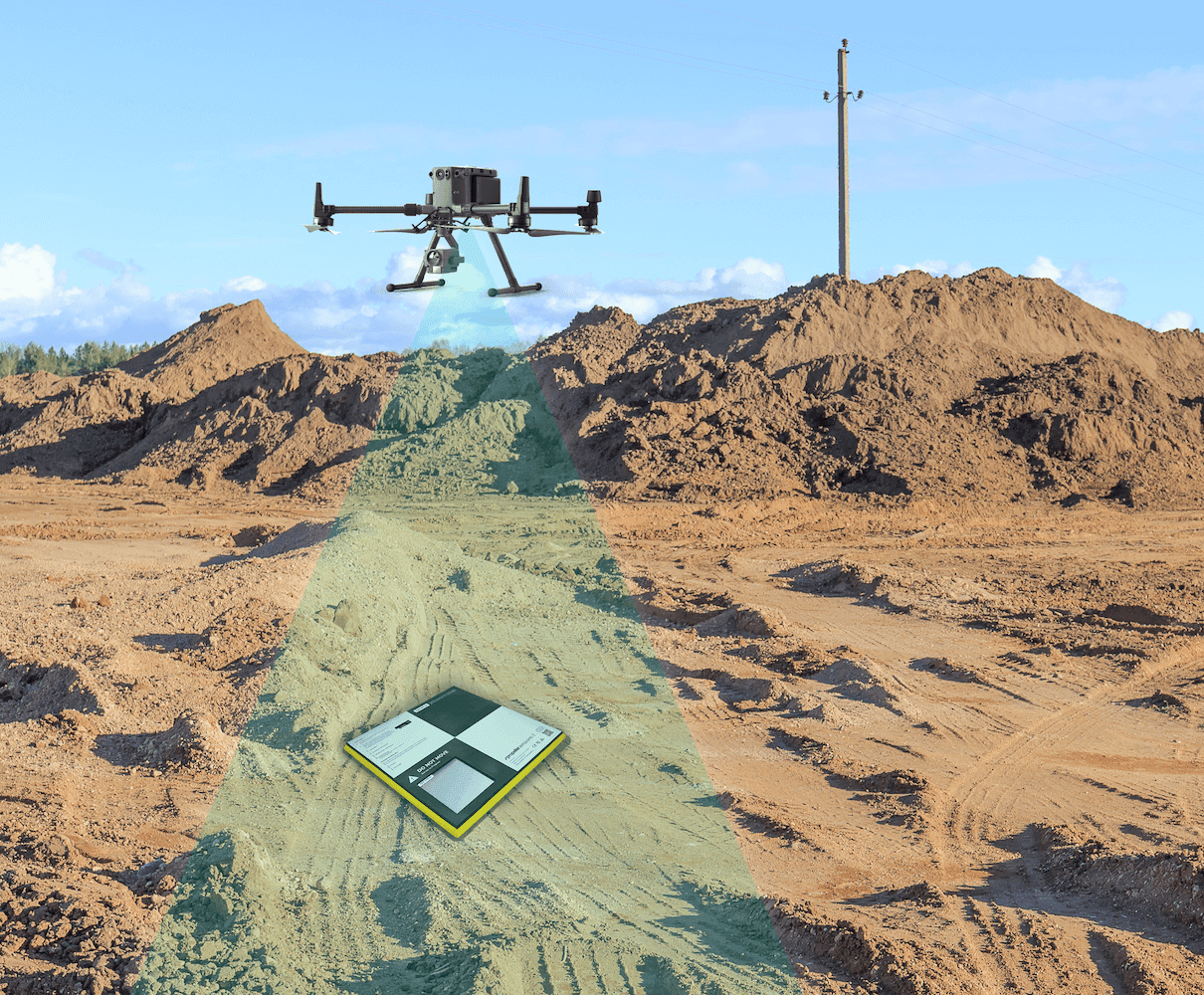
Schnelle RTK-Drohnenaufnahmen liefern Orthofotos (~2,5 cm/px), DGM/DSM, Punktwolken & 3D-Digital-Twins sowie Baum-/Vegetationsdaten. Ausgabe z.B. DXF/LandXML, inkl. GIS-Beratung. Drohnenmiete möglich.
Einfache und schnelle Drohnenaufnahmen von Arealen, Gebäuden und Umgebungen, einschliesslich der Erfassung von Bäumen oder anderen Objekten per GPS oder Absteckung. Der Service bietet präzise Drohnenvermessung mit RTK-Technologie zur Erstellung von hochaufgelösten Orthofotos, Geländemodellen (DSM/DGM) oder 3D-Digital Twins. Bei Bedarf steht auch Drohnenmiete zur Verfügung.
Lieferanten:
Beratung und Begleitung zur Datennutzung im GIS
Datenlieferung in gängigen Formaten (z. B. DXF, LandXML)
Erfassung und Auswertung von Baum- und Vegetationsdaten
Erzeugung von DGM/DSM, Punktwolken und 3D-Modellen (Digital Twin)
RTK-Drohnenflüge für hochauflösende Orthofotos
Ja, Sie können beliebig viele Services in Ihren Warenkorb legen, um ein umfassendes Angebot zu erstellen.
Klicken Sie einfach auf das "X" in der oberen rechten Ecke des jeweiligen Services in Ihrem Warenkorb.
Klicken Sie auf der Service-Seite auf den Teilen-Button (Share). Dadurch wird der Link kopiert und Sie können ihn bequem an andere weiterleiten.
Das sind die konkreten Aufgaben und Leistungen, die in einem Service-Paket enthalten sind. Sie zeigen Ihnen genau, was bei der Buchung geliefert wird.
Fahren Sie mit der Maus über das Anbieter-Symbol auf der Service-Seite oder klicken Sie darauf, um mehr über den Anbieter und seine Partnerschaft mit uns zu erfahren.
Klicken Sie auf das Paket-Symbol, um den Service in Ihren Warenkorb zu legen. Sie finden dieses Symbol unter jeder Service-Karte oder oben auf der jeweiligen Detailseite.
Gehen Sie zum Marketplace und wählen Sie "Nach Kategorie filtern". Alternativ finden Sie auf jeder Service-Seite unten den Bereich "Weitere Services wie dieser".
